


Hurricane Dorian moved very slowly as it crossed the Bahamas over the weekend, inflicting massive damages on the region.
The storm has not had a clear path and continues to baffle researchers, who are unsure which direction it will be headed once it leaves the Bahamas. The hurricane seems to have made a complete stop over the Grand Bahama Island, with record-setting winds being reported on its path.
At its strongest, Dorian registered as a category 5 hurricane, but it slowly downgraded to a category 4 after unleashing fury on the Bahamas. The hurricane currently remains a category 4 storm, but officials are warning that it should not be taken lightly, and evacuations should still be taken very seriously.
The destruction left in the Bahamas has many people in the United States concerned about the path of the storm. Over the weekend, an evacuation of at least 1 million people was ordered in South Carolina and Georgia. The National Hurricane Center has issued hurricane, storm surge, and tropical storm watches and warnings from the Atlantic coast of Florida northward into southeastern Georgia, as the United States braces for the storm.
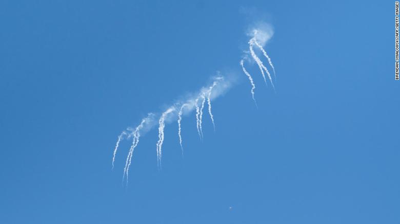
The following Tweet from the National Weather Service shows some of the speeds that were recorded at different locations on Dorian’s path.
9/2 - 12:46 AM | We've gotten quite a few requests for more information about forecast wind speeds & timing with #Dorian. Keep in mind any future track shifts will result in adjustments to this information. pic.twitter.com/smtAfc8Sre
— NWS Melbourne (@NWSMelbourne) September 2, 2019
At around noon on Monday, Dorian was roughly 30 miles northeast of Freeport on Grand Bahama Island, and was moving so slow that its travel speed was just 1 mph. However, despite the slow travel speed, the storm is still producing gusts of nearly 200 mph, and some have said that it could be the strongest storm in recorded history.
September 1, 2019 will probably go down as one of the worst days in Bahamas history…. #HurricaneDorian pic.twitter.com/osyxyNO4hB
— Heather Marie Zons (@HeatherZWeather) September 2, 2019
The good news is that the storm is beginning to weaken, though it is still a stronger storm than most, even in its weakened state. The Hurricane Center predicts that Dorian will continue to weaken as it passes Florida.
This news is no consolation for the people of the Bahamas, who seemed to have gotten the worst that the storm had to offer.
Apparently, this is near Grand Bahama Int'l Airport in Freeport this AM. https://t.co/p7SFY9ipJa
— Jonathan Erdman (@wxjerdman) September 2, 2019
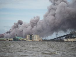
Record-setting winds of nearly 200 mph were reported on the Grand Bahama Island on Monday, creating a massive storm surge that flooded the region and left coastal areas under 18 to 23 of water.
The duration that the hurricane stayed over the island was one of the major factors that caused the situation to be so bad. According to weather experts, the prolonged direct hit resulted in larger storm surges because the hurricane was hovering over the island through multiple high tides.
Kara Doran, leader of the USGS Coastal Change Hazards Storm Team, said that slow-moving hurricanes that remain at sea for long periods of time tend to build up large storm waves, which can sometimes travel hundreds of miles.
Reports that the Grand Bahama Airport is under 5 ft of water.. no surprise considering its location and the onshore flow/storm surge pic.twitter.com/Iv5d22OmWY
— Ari Sarsalari (@AriWeather) September 2, 2019
The Bahamian government has given no official death toll, but the expected forecast is grim. Prime Minister of The Bahamas Hubert Minnis gave a press conference in the wake of the direct hit, and told reporters that this was the worst storm the Bahamas had ever seen. Minnis told the Nassau Guardian that rescue teams won’t be able to conduct search and rescue missions for hurricane victims on Great Abaco Island until Wednesday.
Today I gave a live national briefing on the extremely dangerous #HurricaneDorian from NEMA Headquarters. This is probably the saddest and worst day for me to address the Bahamian people. We are facing a hurricane that we have never seen in The Bahamas. Please pray for us. pic.twitter.com/YOCoOaHI6x
— Dr Hubert Minnis (@minnis_dr) September 1, 2019
Because the storm was so bad and there were so many people evacuated from the Bahamas, there are very few photos or videos showing the extent of the damage. However, some footage was posted online by people who stayed on the island and managed to keep themselves safe.
https://twitter.com/GoGettaGoal/status/1168503969842388995
Minister of Agriculture and Marco City MP Michael Pintard was one of the people who were able to capture some footage of the storm while it was at its peak. His footage can be seen below.
Minister of Agriculture and Marco City MP Michael Pintard, who lives on Grand Bahama, showing some utterly frightening footage of his home during the passage of Hurricane Dorian. pic.twitter.com/gugVsLMroB
— Travis Carroll (@TravisCC) September 2, 2019
There were also a few news broadcasts that were on location to show the devastation caused by Hurricane Dorian, such as ABC World News Tonight with David Muir.
Catastrophic damage reported in northwest Bahamas after Hurricane Dorian
‘CATASTROPHIC’ HURRICANE: Marcus Moore reports from the Abaco Islands, after Hurricane Dorian made landfall in northwest Bahamas as a massive Category 5 storm, calling the situation “pure hell,” adding, “this will no doubt be a deadly event.” https://abcn.ws/34hwPyQ
Posted by ABC World News Tonight with David Muir on Sunday, September 1, 2019
Dorian looks like an extremely threatening storm from space, the following image, posted by the National Oceanic and Atmospheric Administration, shows satellite imagery of the hurricane as it slowly moves towards the United States.
Here's what Category 5 #HurricaneDorian looked like through the night skies early this morning, courtesy of the Suomi NPP satellite. For updates on this extremely dangerous #hurricane: @NHC_Atlantic #Bahamas #GrandBahamaIsland #Abacos pic.twitter.com/0dVZM6Gy5C
— NOAA Satellites - Public Affairs (@NOAASatellitePA) September 2, 2019
The National Hurricane Center has reported that the storm could go in any direction at this point. If just a slight change in timing or wind occurs, the hurricane could end up turning north and not make landfall at all, but many people in the US are not willing to take that chance.